About 569,000 buildings and structures across New South Wales, Victoria, and Queensland are at high risk of bushfires in the next few months, according to the analysis published by PointData, a data and AI analytics company.
“Despite the initial relief provided by a wet commencement to summer along the east coast, the enduring threat of bushfire remains strong,” said George Giannakodakis (pictured below), PointData’s founder and chief executive officer.

The estimated construction costs that came with the risks to buildings and structures amount to more than $504 billion.
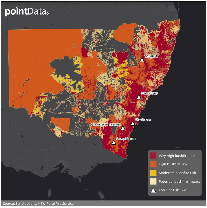
The report found that New South Wales has 284,452 buildings and structures that stand at a high to very high risk from bushfires. This number represents 10% of buildings and structures across the state as well as 18.4% in the region.
Potentially, the cost to rebuild these buildings and structures could equate to a total of $249 billion.
The top five Local Government Areas (LGAs) that have the highest number of buildings and structures that are under high to very high risk are the following:
Below is the bushfire risk map for New South Wales.
Victoria has a total of 176,329 buildings and structures that are at high risk from a bushfire. This represented about 6.6% of buildings and structures throughout the state and 16.7% of those in the region.
The potential cost to rebuild these buildings and structures totalled to $144 billion.
The top five LGAs that had the highest number of high-risk buildings and structures are the following:
Below is the bushfire risk map for Victoria.

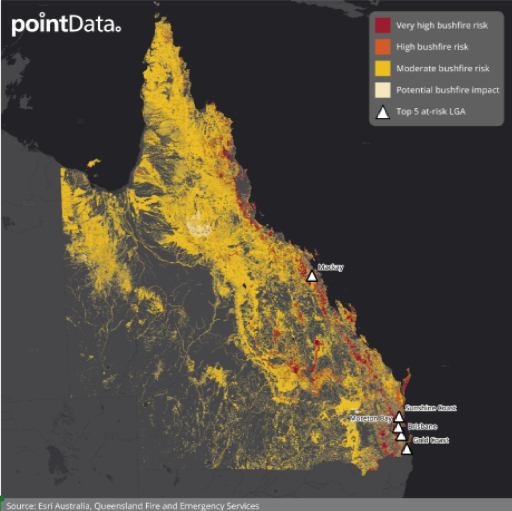
Queensland has 108,160 buildings and structures that face a high to very high risk from bushfires which amounted to 15.2% of buildings and structures throughout the state and 8.9% of those in the region. It may potentially cost $111 billion to rebuild them.
Its top five LGAs that have the highest number of buildings and structures under high to very high risk are the following:
Below is the bushfire risk map for Queensland.
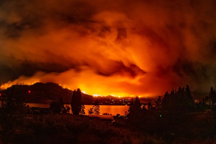
“The devastating consequences of previous bushfire seasons, such as those witnessed in 2019-2020, serve as a stark reminder of the potential impact on lives, property, and the environment,” said Giannakodakis.
“Adequate planning and understanding the risk on properties and buildings are crucial components of mitigating the potential financial risk of major events.”
The PointData Bushfire Risk Index used AI and machine learning to provide a climate impact overlay across the Australian east coast.